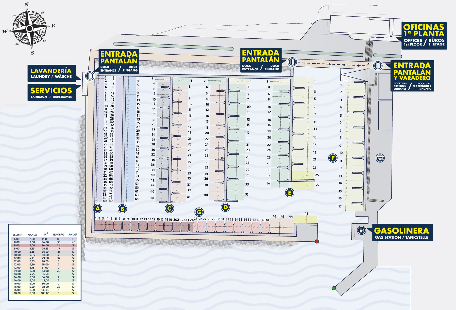
SERVICES
 Harbour Master´s office
 Deckhand services
 Radio VHF (monitoring)
 Changing rooms
 Potable (Drinking) Water
 Power supply
 Wi-Fi
Wi-Fi
 Weather information
 Bookings
 Launderette
 Petrol station
 (Waste) Oils
 Wastewater
 Solid waste
 Marina Forklift 1.5T
 Boat ramp
SERVICE BUILDING
Located in front of the boatyard, behind the main avenue is the Service Building. The DISA petrol (fuel) station is situated here along with a convenience store offering a wide range of items. Adjacent to it is TIENDA LAURISILVA, a shop selling typical regional products as well as souvenirs.
At building´s street level you can find RESTAURANTE CAPRICHOS DE LA GOMERA, run by the renowned chef Fabián Mora, where you can savour a perfect blend of modern and traditional cuisine.
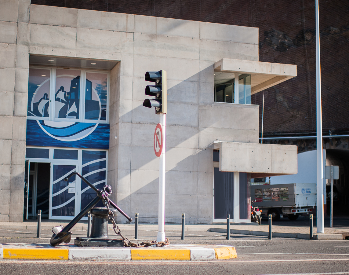
On the first floor of the Service Building is the new Harbour Master´s Office, inaugurated in 2020, where our administration staff will attend to customers´ requirements.
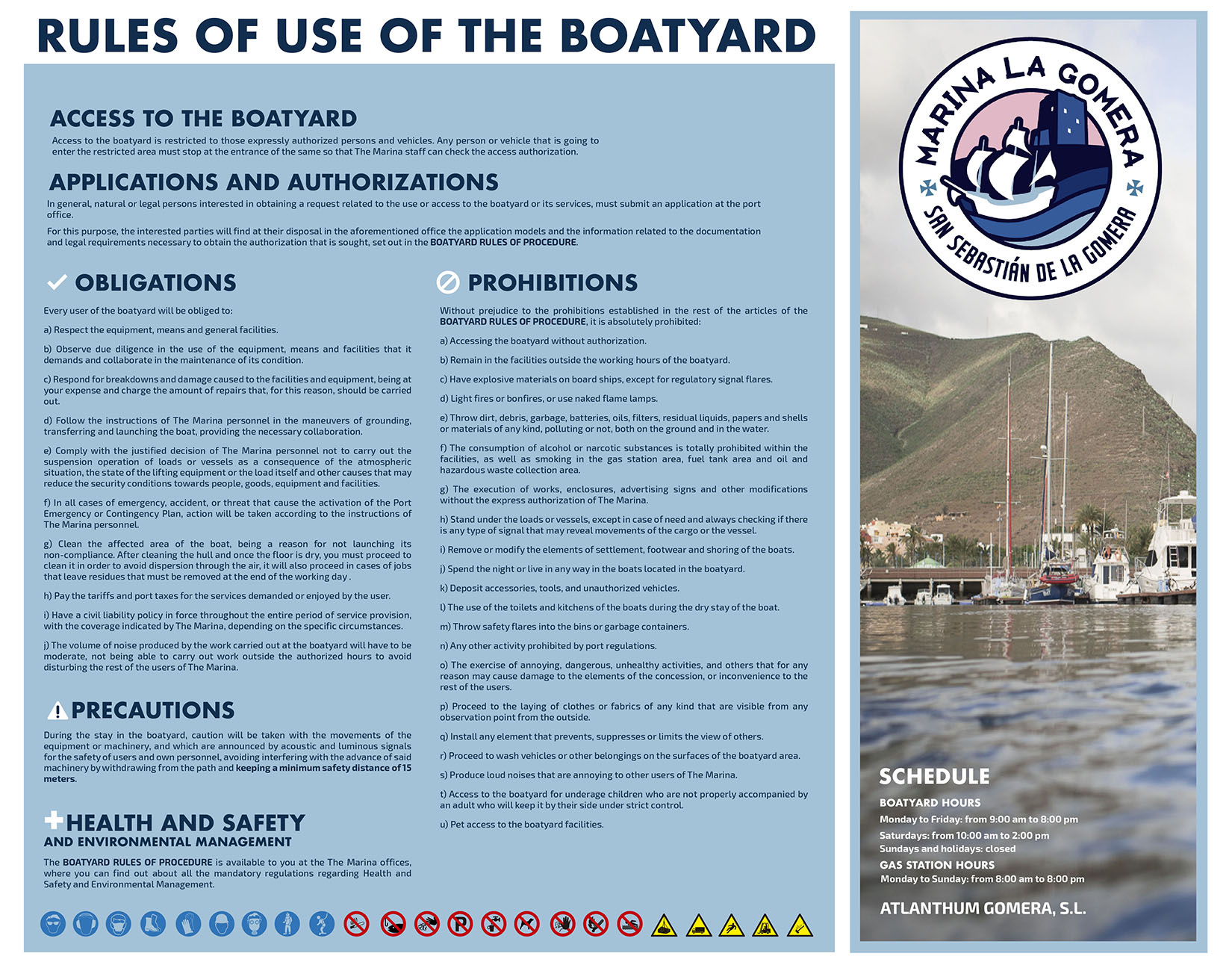
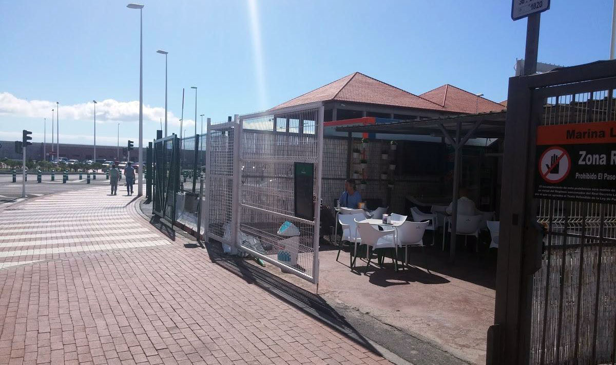
THE BOATYARD
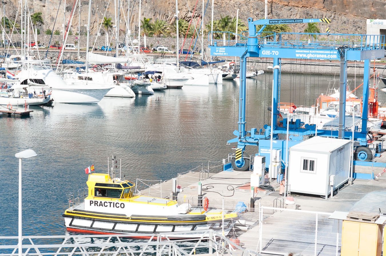
The boatyard, almost 2700m2 in area, is where all the general maintenance and repair work for boats takes place and in the entrance channel, is the (petrol)fuelling station(dock), providing both Diesel and petrol for vessels. The marina is also equipped with a boat hoist for vessels up to 7 metres and disposal containers for waste oil and batteries.
The company SOLUCIONES NAVALES can provide a Travel-lift GH-70 and Boat Lift BL-20 for the dry docking(grounding), transport and launching of boats of up to 18 metres in length and carry out all kinds of maintenance jobs. For further information visit their web page www.varaderogomera.com.
BAR-KIOSK PEJEVERDE
Within the boatyard and adjacent to the main avenue is the BAR-KIOSK PEJEVERDE, open from 07:00 to 22:00 and offering a great variety of food and drink for visitors.
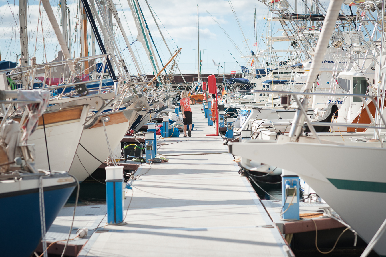
290 moorings
Capacity
20 m.
Length overall (LOA)
1 m.
Minimum draft
10 m.
Maximum draft
LOCATION (COORDINATES)
Latitude: 28° 05′ 00» N
Longitude: 17° 06′ 00» W
Port entry lights: GpCt (3)V9s – GpCt (2)R7s
Radio: VHS – Ch 9 & 16
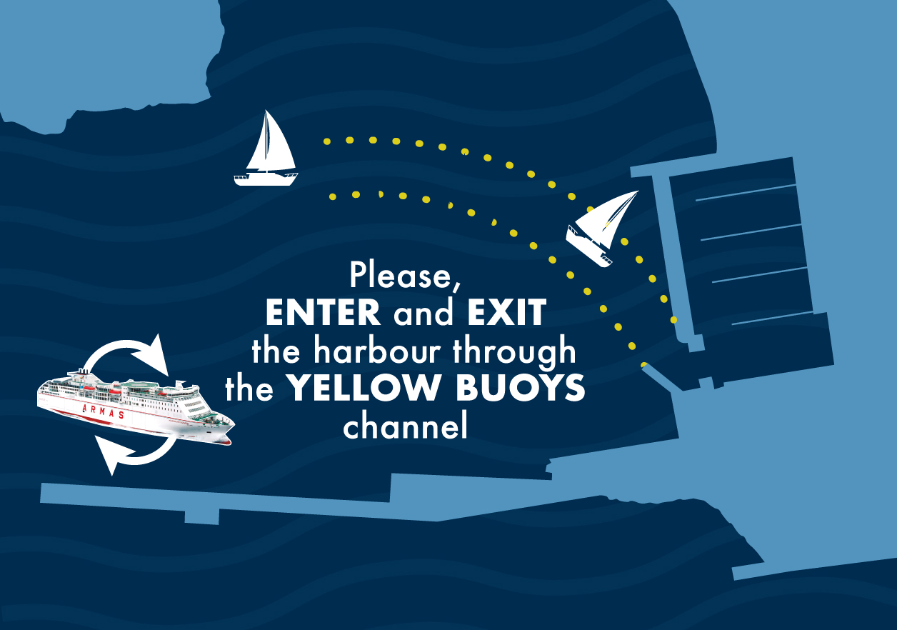
Please, call the marina BEFORE approaching.
HOW TO APPROACH THE MARINA
Please call the marina before approaching. VHF channel: 9
The port installations are protected by a large breakwater, located SW, 40m wide and 12m maximum draft. The arrival procedure to the port is simple: Sail as required from the end of the breakwater, following the buoyed channel and taking precaution not to steer the boat toward the interior too close to the breakwater in case of passenger ferries leaving the marina.